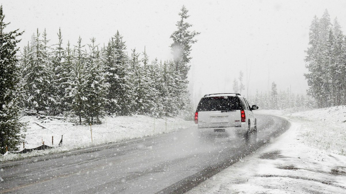
You check road conditions by visiting your local Department of Transportation website for real-time maps, closures, and traffic cameras. Mobile apps like Waze and Google Maps are the most convenient alternative, using GPS and user reports to tailor updates to your exact route. For a safe trip, check the DOT site shortly before you leave and again during your journey, as conditions change rapidly in bad weather or peak traffic.
Local Department of Transportation Websites
When it comes to checking road conditions, one of the most reliable sources of information is the website of your local department of transportation (DOT). These websites provide real-time updates on road closures, construction projects, and any other incidents that may affect your travel plans. To access this information, simply visit the website of your local DOT and look for a section related to road conditions or travel information. Here, you can find details about major highways, interstates, and state routes. Most websites have interactive maps that allow you to zoom in on specific areas and view the current road conditions. In addition to real-time updates, DOT websites often provide other useful information such as traffic cameras, weather conditions, and even estimated travel times. Some websites also offer the option to sign up for email or text alerts, so you can receive notifications about road closures or accidents affecting your route. It's important to note that road conditions can change rapidly, especially during inclement weather or peak travel times. Therefore, it's a good idea to check the local DOT website shortly before your trip and during your journey to stay informed about any updates or detours. Local DOT websites are especially valuable when traveling through different states or regions, as you can access information specific to each area. This means you can stay informed about road conditions whether you're driving across the state or traveling cross-country. Overall, local DOT websites are a reliable and comprehensive resource for checking road conditions. They provide accurate and up-to-date information that can help you make informed decisions and adjust your travel plans accordingly. So, be sure to visit the website of your local DOT before hitting the road to ensure a safe and smooth journey.
Mobile Apps for Road Conditions
In today's digital age, mobile apps provide convenient, real-time updates on traffic, accidents, and road closures. These apps use GPS technology to track your location and deliver information tailored to your route, helping you navigate congested areas, avoid roadblocks, and find alternative routes. Popular mobile apps include Waze, Google Maps, and Apple Maps. They offer turn-by-turn navigation, estimated travel times, and real-time updates from other users. Waze stands out for its user-generated content, relying on a community of millions of drivers who report accidents, hazards, and traffic conditions, ensuring you receive the most up-to-date information. When using these apps, ensure you have a stable internet connection for accurate, timely updates. Also enable GPS on your mobile device so the app can track your location and provide precise directions based on your current position. Mobile apps are readily accessible on your smartphone or tablet, allowing you to check road conditions anytime, anywhere—ideal for both local and long-distance travel. Familiarize yourself with the app’s features before your trip to maximize its benefits. For example, if you need to locate my reservation on Expedia or modify reservation on Expedia, these apps won’t help, but they excel at real-time navigation. Overall, they offer real-time updates and navigation assistance, helping you avoid traffic congestion for a smoother, more efficient journey.
Online Maps and Traffic Updates
In addition to dedicated road condition apps, online maps and traffic updates on websites like Google Maps, Bing Maps, and MapQuest provide real-time traffic information. To check road conditions, enter your starting point and destination. The map displays color-coded indicators: green for smooth traffic flow, yellow for moderate congestion, and red for heavy traffic. These services also show accidents, road closures, construction zones, and other incidents along your route, with frequent updates for accuracy. You can zoom in and out to examine specific areas and analyze traffic severity. Some maps offer alternate route suggestions to avoid congestion and delays. Many online maps include satellite imagery and street view options for a visual representation of road conditions and obstacles. Note that some maps require an internet connection for real-time updates, while others allow offline downloads—check if your preferred service offers offline functionality before relying on it. Online maps are user-friendly tools that provide a visual representation of traffic flow and suggest alternative routes to optimize your journey. Leverage them when planning your next trip to avoid unnecessary traffic headaches.
GPS Devices with Live Traffic Updates
If you prefer a dedicated device for navigation and road condition updates, GPS devices with live traffic updates are a reliable option. These devices offer comprehensive mapping services along with real-time traffic information to help you plan your route effectively. GPS devices with live traffic updates utilize satellite technology to provide accurate and up-to-date information about road conditions, accidents, and traffic congestion. They receive data from various sources, including traffic sensors, government agencies, and other GPS users, to offer the most comprehensive coverage. To use a GPS device for road condition updates, simply enter your destination, and the device will display your route along with any potential roadblocks, construction zones, or traffic incidents. The device will also provide alternative routes if available, allowing you to avoid congestion and arrive at your destination more efficiently. One of the main advantages of using a GPS device is that it doesn't rely on internet connectivity like mobile apps or online maps. GPS devices store detailed maps and traffic data internally, ensuring that you receive consistent updates regardless of your location or network coverage. Furthermore, GPS devices are designed specifically for navigation purposes and offer a user-friendly interface optimized for on-the-road use. They often include helpful features like voice-guided directions, lane assistance, and speed limit warnings to enhance the overall driving experience. Keep in mind that GPS devices with live traffic updates may require a subscription or an additional fee for accessing the traffic data. However, the cost is usually justified by the convenience and accuracy of the information provided. Overall, GPS devices with live traffic updates offer a dedicated and reliable solution for checking road conditions. They provide detailed mapping services, real-time traffic updates, and navigation assistance to ensure a smooth and efficient journey. Consider investing in a GPS device if you frequently travel by car and prefer a dedicated device for road condition updates.
Social Media Platforms for Road Condition Updates
In recent years, social media platforms have emerged as a valuable source of road condition updates. Platforms like Twitter and Facebook can provide real-time updates on accidents, road closures, construction zones, and other incidents that may impact your travel plans. To access these updates, follow official accounts of local transportation agencies, police departments, and news outlets in the areas you'll be traveling through. These accounts often post timely information about road conditions, detours, and other relevant updates. Additionally, hashtags such as #trafficupdate or #roadclosure can be used to search for specific updates from various sources, including fellow travelers, news organizations, and authorities. Another useful feature is the ability to engage with other users. You can ask questions related to road conditions or share your own experiences to help fellow travelers. This interactive element allows for real-time conversations. It's important to note that the reliability and accuracy of social media updates may vary. Therefore, cross-reference information with other reliable sources, such as local DOT websites—look for a section related to road conditions or travel information—or official traffic reports. To stay updated, check social media periodically before and during your journey, and consider enabling push notifications for the accounts you follow to receive instant updates on your smartphone or tablet. Overall, social media platforms offer a dynamic way to stay informed about road conditions, providing real-time updates and a platform for sharing firsthand experiences. For example, you might use these platforms to locate my reservation on Expedia if your travel plans change due to a road closure, or to scan a passport if you need to verify identification at a checkpoint. So, don't overlook the power of social media when seeking road condition updates for your next trip.
Weather Websites and Apps
When it comes to planning a trip and checking road conditions, weather plays a significant role. Inclement weather such as heavy rain, snowstorms, or fog can greatly impact road conditions and make driving hazardous. Therefore, using weather websites and apps can be a valuable resource to stay informed about current and upcoming weather conditions along your route. Weather websites and apps such as Weather.com, AccuWeather, and The Weather Channel provide comprehensive weather forecasts, including information on precipitation, wind speed, visibility, and temperature. These forecasts can help you determine if you need to adjust your travel plans due to adverse weather conditions. In addition to general weather forecasts, some websites and apps offer specific features that are relevant for road conditions. For example, they may provide alerts for severe weather such as hurricanes, tornadoes, or flash floods, which can cause road closures or unsafe driving conditions. Most weather websites and apps also include radar maps that allow you to track weather patterns in real-time. These radar maps can help you anticipate and plan for weather-related road conditions along your route. Furthermore, some weather apps integrate with other navigation or road condition apps, providing a seamless experience for checking both the weather and road conditions within a single platform. This integration allows you to have a holistic view of the conditions that may affect your journey. To utilize weather websites and apps effectively, ensure that you have a stable internet connection or have downloaded the necessary maps or data for offline use. This way, you can access the most up-to-date weather information even if you're in an area with limited internet access. By considering weather conditions alongside road conditions, you can make informed decisions and adjust your travel plans accordingly, ensuring a safer and more enjoyable trip. For example, if you need to add your Delta SkyMiles number to an existing reservation, you can do so through the airline’s website after checking conditions. In summary, weather websites and apps offer a valuable resource for checking road conditions by providing comprehensive weather forecasts, alerts for severe weather events, and radar maps. By utilizing these tools, you can stay informed about potential weather-related road hazards and make well-informed decisions for your journey.
Radio Traffic Reports
For travelers who prefer traditional methods, radio traffic reports remain a reliable source of road condition updates. Local radio stations provide regular traffic updates throughout the day, especially during peak travel times, keeping drivers informed about incidents, congestion, or road closures. These reports are typically broadcast at specific intervals or on the hour, covering major highways, interstates, and main thoroughfares. On-air personalities deliver detailed information about accidents, construction zones, and traffic flow. To access radio traffic reports, tune in to local AM or FM stations that specialize in news, weather, and traffic updates. Many stations have dedicated traffic segments, ensuring listeners have the information needed to navigate effectively. A key advantage of radio traffic reports is their immediacy and local focus. Stations tailor updates to the specific region they serve, making them useful for travelers within a particular area or those driving through multiple regions. Reports often incorporate information from law enforcement agencies, transportation departments, and eyewitness reports, offering a comprehensive overview of current road conditions. Note that radio traffic reports are typically limited in coverage area and may not provide as extensive or real-time information as digital resources. It is beneficial to combine them with other methods, such as mobile apps or online maps, for a more complete picture. For example, while listening to radio reports can help you avoid local hazards, you might also use a digital tool to locate my reservation on Expedia if your trip requires accommodation changes due to a road closure. When listening, pay attention to the station's frequency and signal strength. Reception issues or weak signals can occur, especially in rural or remote areas. In such cases, consider tuning in to a different local station or using alternative methods for updates. In summary, radio traffic reports offer a traditional yet effective means of checking road conditions. By tuning in to local stations, you can receive timely updates about accidents, construction, and traffic congestion, helping you make informed decisions for your journey.
Local News Websites and Apps
Another reliable source of road condition updates is local news websites and apps. News outlets often have dedicated sections on their websites and apps that provide comprehensive information about traffic incidents, road closures, and other relevant updates. Local news websites are a valuable resource because they cover a wide range of topics, including the latest traffic news. They often feature articles, videos, and live updates from reporters and traffic helicopters, providing real-time information about road conditions in your area. To access road condition updates on local news websites and apps, simply visit their respective websites or download their mobile apps. Look for sections such as "Traffic" or "Travel" to find detailed information about accidents, road closures, construction projects, and traffic congestion. News websites and apps may also incorporate real-time traffic maps, which display current road conditions, traffic flow, and any areas to avoid. These maps often have color-coded designations, similar to online maps and GPS devices, to indicate traffic congestion levels. Furthermore, local news outlets may provide live streaming or recorded video footage from traffic cameras positioned at key intersections or along major highways. This visual information can give you a better understanding of the current road conditions and help you plan your route accordingly. It's important to note that local news websites and apps are focused on specific regions or cities, which makes them especially helpful for travelers who are exploring a specific area. They offer localized updates that may not be as comprehensive on national platforms. To stay up to date with road conditions, consider subscribing to email or push notification alerts from local news websites or apps. This way, you can receive instant updates about any incidents or road closures that may affect your travel plans. In summary, local news websites and apps provide valuable and localized information about road conditions. They offer comprehensive coverage of traffic incidents, road closures, and congestion, helping you make informed decisions and navigate the roads effectively.
Road Condition Hotlines
One often overlooked but reliable resource for checking road conditions is road condition hotlines. These hotlines are typically operated by state or local transportation departments and provide up-to-date information about road closures, construction, and other incidents that may impact your travel plans. You can also dial the designated phone number for the specific region you'll be traveling through. These hotlines are staffed by transportation department personnel who can provide real-time updates and answer any questions you may have about road conditions. The advantage of road condition hotlines is that they offer direct and official information from trusted sources. The personnel manning the hotlines are well-informed about the current state of the roads and can provide accurate and timely updates based on the latest information. Hotlines are particularly useful when you don't have access to the internet or when other sources of information are not available. Whether you're traveling through remote areas or experiencing network issues, road condition hotlines provide a reliable means of obtaining essential information about the roads ahead. It's important to note that road condition hotlines may have limited operating hours, especially during non-business hours or holidays when staffing levels may be reduced. Therefore, it's a good idea to check the hours of operation in advance or have an alternative method of obtaining road condition updates. When calling a road condition hotline, be prepared to provide your location and ask specific questions about the route you plan to travel. This will help the personnel on the other end of the line provide you with the most accurate and relevant information. In summary, road condition hotlines offer a direct and reliable means of checking road conditions. They provide up-to-date information about road closures, construction, and other incidents, ensuring that you have the necessary information to plan your journey accordingly.
Contacting Local Law Enforcement Agencies
When it comes to obtaining accurate and real-time information about road conditions, contacting local law enforcement agencies can be a valuable resource. These agencies have firsthand knowledge of accidents, road closures, and other incidents that may impact your travel plans. To contact local law enforcement agencies regarding road conditions, you can typically find their non-emergency phone numbers listed online or in local directories. It's important to remember that emergency lines should only be used for immediate and urgent situations. Law enforcement agencies can provide you with information about traffic incidents, road closures, and detours in their jurisdiction. They are often in direct communication with transportation departments, road crews, and other relevant authorities. One advantage of contacting law enforcement agencies is that they can provide you with specific details about road conditions that may not be readily available through other sources. They can offer insights into the severity of accidents, estimated clearance times, and alternative routes to consider. It's important to note that law enforcement agencies are typically busy, so it's advisable to be patient when contacting them for road condition updates. They may have limited resources available to provide information to individual callers, especially during peak travel times or major incidents. When contacting law enforcement agencies, provide them with your location, planned route, and any specific concerns or questions you may have. This will help them give you the most relevant information and assist you in making informed decisions for your journey. While it's essential to rely on official sources for road condition updates, keep in mind that law enforcement agencies may prioritize emergency response and public safety over providing road condition information. Therefore, it's useful to combine this method with other sources, such as local news websites or GPS devices, to get a comprehensive picture of the road conditions. In summary, contacting local law enforcement agencies can provide valuable and specific information about road conditions. They are well-informed about accidents, road closures, and detours in their jurisdiction and can help you navigate through potential hazards. Consider reaching out to them for accurate and timely updates during your trip.
Conclusion
Checking road conditions before a trip is essential for a safe and smooth journey. By using a combination of resources, you can stay informed about accidents, road closures, and traffic congestion, allowing you to plan alternative routes and avoid delays. In this article, we explored ten ways to check road conditions. From local department of transportation websites and mobile apps to online maps, GPS devices, and social media platforms, numerous resources provide up-to-date information. Local department of transportation websites offer comprehensive information about road closures, construction zones, and current traffic conditions. Mobile apps like Waze, Google Maps, and Apple Maps provide real-time updates and navigation assistance tailored to your route. Online maps and traffic updates offer a visual representation of current traffic flow and can suggest alternate routes. GPS devices with live traffic updates provide dedicated navigation and real-time information about accidents and road conditions. Social media platforms can be used to follow local transportation agencies, police departments, and news outlets for updates. Weather websites and apps help you stay informed about conditions that may impact roads. Radio traffic reports provide immediate, localized information about accidents, congestion, and closures. Local news websites and apps cover traffic incidents with interactive maps and videos. Road condition hotlines and contacting local law enforcement agencies offer direct, official information about closures and incidents in real time. By using a combination of these resources, you can gather accurate updates to make informed decisions and plan your trip. Check sources periodically for the most current information. Stay safe and enjoy your journey by staying informed. Happy travels!