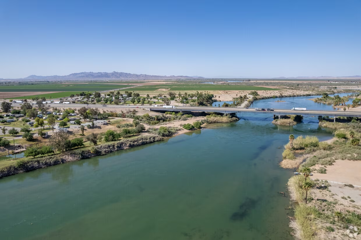
Blythe, California: On the Arizona Border
Blythe, California, sits directly on the California–Arizona state line, so the distance from the center of town to the border is 0 miles. The city's eastern edge is defined by the Colorado River, which also serves as the boundary between the two states.
Blythe is a small desert city in Riverside County, roughly 100 miles east of Palm Springs, at the junction of Interstate 10 and State Route 78. Its position on the river has made it a historic crossing point and a practical stop for travelers on the I-10 corridor between Southern California and Arizona. The town of Ehrenberg, Arizona, lies just across the river, and the larger community of Quartzsite is about 20 miles east on I-10.
Because Blythe is on the border, the straight-line distance to the state line is zero. The nearest Arizona town, Ehrenberg, is about 1.5 miles from Blythe's center when measured directly across the river, but the driving distance via the interstate is roughly 6 miles. This distinction matters for anyone planning to cross into Arizona: the border itself is immediate, but the first town center is a short drive east.
Location and Geography
Blythe lies in the Palo Verde Valley, an agricultural oasis fed by the Colorado River. The river here is wide and slow, and the surrounding terrain is typical Sonoran Desert – flat, arid, and dotted with creosote bushes and palo verde trees. The city's location at the intersection of I-10 and State Route 78 makes it a natural gateway between the coastal areas of California and the interior Southwest.
On the Arizona side of the river, the land rises gradually toward the Kofa Mountains and the Sonoran Desert. Ehrenberg is the first community you encounter, a small town with a few gas stations, motels, and convenience stores catering to highway traffic. Farther east, Quartzsite is known for its massive gem and mineral shows in the winter, when thousands of snowbirds and rockhounds descend on the area.
The Colorado River itself is a major recreational draw. Boating, fishing, and jet-skiing are popular in the summer, and the riverbanks are lined with campgrounds and RV parks. On the California side, the nearby Chocolate Mountains and the Cargo Muchacho Mountains offer hiking and off-road trails, though some areas are closed to the public due to military training operations.
Blythe's position on the border also places it within reach of several national parks and monuments. Joshua Tree National Park is about 90 miles west, while the Sonoran Desert National Monument in Arizona is roughly 120 miles east. The town's elevation is about 270 feet, and summer temperatures regularly exceed 110°F, so most visitors time their trips for the fall, winter, or spring.
Distance to the Border and Nearby Arizona Towns
Since Blythe is on the border, the distance to the state line is 0 miles. The nearest Arizona settlement, Ehrenberg, is about 1.5 miles from Blythe's center as the crow flies, but the closest bridge over the Colorado River is at the end of West Hobson Way, which becomes Ehrenberg Road. That crossing puts you in Arizona within about 2 miles of downtown Blythe.
The driving distance from Blythe's main intersection (I-10 and US 95) to the Ehrenberg exit on the Arizona side is approximately 6 miles. This route takes you over the Colorado River bridge and along the frontage road that parallels the interstate. The drive typically takes less than 10 minutes in normal traffic.
Quartzsite, Arizona, is about 20 miles east of Blythe on I-10. This town is famous for its winter population boom, when the number of residents swells from a few hundred to tens of thousands during the annual rock and gem shows. If you're heading to Phoenix, it's another 120 miles east of Quartzsite, making Blythe a convenient overnight stop on a longer cross-country trip.
For those interested in exploring Arizona's interior, the border crossing at Blythe is one of the least congested on the California–Arizona line. Unlike the busy crossings at Yuma or Needles, you can usually cross here with minimal delay, even during peak travel seasons. The town also has a small airport, the Blythe Airport, which handles general aviation and occasional commercial flights.
Factors That Affect Travel Distance
While the straight-line distance from Blythe to the border is 0 miles, the actual distance you travel to reach specific destinations in Arizona can vary based on several factors. The most obvious is your choice of bridge crossing. There are only two bridges over the Colorado River in the Blythe area: one for I-10 and one for the old US 95 alignment that runs through town. If you're heading to Ehrenberg, the I-10 bridge is the most direct route, but if you're going to the southern part of town, the old bridge might be closer.
Terrain also plays a role. The land on the Arizona side is mostly flat, but there are low hills near the river that can add a mile or two to certain routes. The roads themselves are well-maintained, but during the summer monsoon season, flash floods can occasionally close low-water crossings, forcing detours.
Traffic is generally light in this area, but the I-10 corridor can back up during holiday weekends, especially at the California Agricultural Inspection Station near the border. This checkpoint is mandatory for all vehicles entering California, and wait times can range from a few minutes to over an hour during peak travel periods.
Navigation apps sometimes suggest alternate routes through the desert, but these are rarely faster and can be poorly signed. For most travelers, the most reliable route is simply to stay on I-10 and take the Ehrenberg exit.
Practical Information for Visitors
Blythe has a population of about 18,000 people, and the town offers a range of services for travelers, including several chain hotels, motels, and RV parks. There are also a number of local restaurants serving Mexican and American cuisine, as well as a few fast-food options. The town has a Walmart Supercenter, a grocery store, and several gas stations that stay open late.
For those interested in history, the Palo Verde Valley Museum and Historical Society has exhibits on the area's Native American heritage, the river's role in settlement, and the agricultural industry that still dominates the local economy. The nearby Cibola National Wildlife Refuge, about 20 miles south of town, is home to migratory birds and offers hiking trails and wildlife viewing.
If you're crossing into Arizona, the town of Ehrenberg has a few services, including a truck stop, a casino, and a handful of restaurants. Farther east, Quartzsite is a popular destination for rockhounds and off-road enthusiasts, with the Imperial Dam and the Kofa National Wildlife Refuge nearby.
One thing to keep in mind is that the California side of the border observes Pacific Time, while Arizona is on Mountain Standard Time (except for the Navajo Nation, which observes daylight saving time). This means that during most of the year, there is a one-hour time difference between Blythe and Ehrenberg, even though they're only a few miles apart. Be sure to adjust your watch when you cross.
For those planning a longer trip, the city of Phoenix is about 180 miles east of Blythe, a drive of roughly 2.5 hours on I-10. Tucson is about 280 miles southeast, and San Diego is about 200 miles west. This makes Blythe a convenient base for exploring the broader Southwest, though most visitors use it as a stopover rather than a destination in itself.
If you're interested in hidden gems, the area around Blythe has a few lesser-known attractions. The "Mystery Castle" in the nearby desert is a quirky roadside attraction, and the "Palo Verde Ecological Reserve" offers birdwatching opportunities. For a more unusual experience, consider visiting the "Blythe Intaglios," a series of ancient geoglyphs etched into the desert floor about 15 miles north of town. These figures, which include a giant human and a serpent, are best viewed from the air, but there is a small viewing platform on the ground.
In terms of outdoor recreation, the Colorado River is the main draw. You can rent a kayak or pontoon boat at one of the local marinas, or simply find a quiet spot on the bank to fish for bass and catfish. The river is also popular for swimming, though the current can be strong in places, so always check conditions first.
For hikers, the nearby Mule Mountains offer a few trails, but the desert heat makes summer hiking dangerous. The best time to explore is between October and April, when daytime temperatures are mild. Winter nights can be cold, with temperatures occasionally dropping below freezing, so pack layers.
If you're traveling with children, the "Blythe River Park" has a playground, picnic areas, and a small beach. There's also a golf course, the "Palo Verde Golf Course," which is open to the public and offers a challenging layout amid the desert landscape.
When planning your trip, keep in mind that services on the Arizona side of the border are more limited than in Blythe. If you need a pharmacy, a hospital, or a wide selection of stores, it's best to stock up before crossing. The nearest major hospital is in Blythe, and the closest full-service airport is in Palm Springs, about 100 miles west.
Crossing the Border
The border crossing at Blythe is straightforward for most travelers. You don't need a passport to cross between California and Arizona, but you will need one if you're coming from outside the United States. The crossing is open 24 hours a day, 7 days a week, and there are no tolls.
If you're driving a rental car, check with the rental company to make sure you're allowed to cross state lines. Most allow it, but some have restrictions on certain types of vehicles, such as trucks or SUVs. You should also be aware that California has strict emissions laws, and some rental cars are not permitted to be driven out of state.
For those traveling by RV or towing a trailer, the crossing is wide and well-maintained, with plenty of room to maneuver. There are also several truck stops on both sides of the border where you can refuel or take a break.
If you're interested in exploring Arizona's "mysteries and secrets," the area around Quartzsite is known for its abandoned mines and ghost towns. The "lost mines and travel in Arizona" theme is a popular one, and there are several guidebooks that cover the region. However, be cautious when exploring old mine shafts, as they can be unstable and dangerous.
For a more comfortable experience, consider taking a guided tour of the area. Several local outfitters offer jeep tours of the desert, including visits to the Intaglios and other archaeological sites. These tours typically last a few hours and include water and snacks.
If you prefer to explore on your own, make sure you have plenty of water, a map, and a fully charged phone. Cell service can be spotty in the desert, so don't rely on GPS alone. It's also a good idea to let someone know your plans before heading out.
One final note: while Blythe is on the border, it's not a border town in the traditional sense. There are no fences or checkpoints on the California side, and the border is marked only by the river. You can stand on the bank in California and throw a rock into Arizona, but you'll need a bridge to cross legally.
Nearby Attractions and Activities
Beyond the border itself, the region offers a range of attractions for visitors. On the California side, the "Chocolate Mountains" are a designated wilderness area with hiking and camping opportunities, though some parts are closed for military use. The "Mule Mountains" to the south have several mining ruins, and the "Palo Verde Mountains" to the north are home to bighorn sheep.
In Arizona, the "Kofa National Wildlife Refuge" is a hidden gem, with dramatic mountain scenery and the famous "Palm Canyon," where a small grove of native palm trees grows in a narrow canyon. The refuge is about 60 miles east of Blythe, and the last few miles are on a dirt road that's passable for most vehicles.
For those interested in history, the "Arizona Historical Society" in Phoenix has exhibits on the state's early settlers, and the "Heard Museum" in Scottsdale is dedicated to Native American art and culture. Both are about a 2.5-hour drive from Blythe.
If you're looking for a shorter excursion, the town of Parker, Arizona, is about 60 miles north of Blythe on the Colorado River. Parker is home to the "Blue Water Casino" and several riverfront parks, and it's a popular spot for boating and fishing.
For a unique experience, consider visiting during the "Blythe Bluegrass Festival," which takes place every February. The festival features live music, food vendors, and craft booths, and it's a great way to experience the local culture.
No matter what you're interested in, the Blythe area has something to offer. Its location on the border makes it a natural starting point for exploring both California and Arizona, and its small-town charm is a welcome break from the hustle and bustle of larger cities.
Conclusion
Blythe's position directly on the California–Arizona border means the distance to the state line is 0 miles. The city's eastern boundary is the Colorado River, which separates the two states, and the nearest Arizona town, Ehrenberg, is just a short drive across the bridge.
For travelers, this means you can easily visit both states in a single day. Whether you're crossing into Arizona to explore the desert, or staying in California to enjoy the river, Blythe offers a convenient and affordable base. The town has all the essential services you need, and the surrounding area is full of natural beauty and historical interest.
When planning your trip, keep in mind the time difference and the fact that services are more limited on the Arizona side. But with a little preparation, you'll find that Blythe is a welcoming and practical stop on any Southwest road trip.
So, pack your bags, fill up your tank, and head to Blythe. The border is right there, waiting for you to cross.